weblog 2011 |
|
[home] [weblog] [science] [people] [station] [ny-ålesund] [sightings] [sitemap] [nederlands] |
|
Old marble quarry re-discovered | 24 July 2011 20:00 |
 |
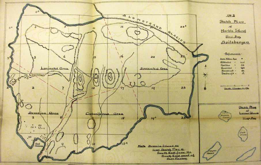
On Spitsbergen, history is frozen and discoveries can be made. Today, we re-discovered an old marble quarry at Blomstranden. The story starts at the Arctic Centre of the University of Groningen in The Netherlands, where Ph.D. student Frigga Kruse is studying British prospecting and mining on Spitsbergen as part of the LASHIPA project. In the archives of the Norwegian Polar Institute in Tromsø, she discovered a report by Herbert W. Leech of the Northern Exploration Company LTD from 1920 entitled: Report on various marble properties in Spitsbergen. In this report there is a map, showing Blomstranden in Kongsfjorden. On this maps there are bore holes, buildings and quarries. Frigga compared all marks with her findings during an earlier field survey and discovered one little Q (for quarry) on an unexpected spot. She asked the crew of the Netherlands Arctic Station for a survey. It took us two visits to find the place. The first visit on 9 July, we missed it by a few hundred meters. After comparing our GPS data with modern maps, we decided on a second try. |
 |
||||
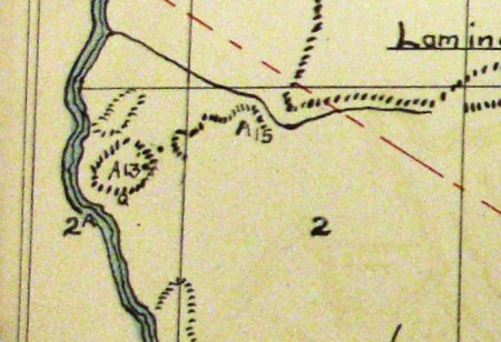
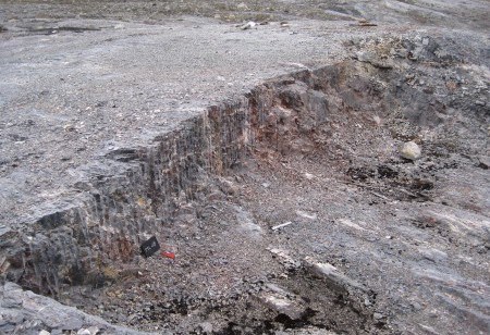
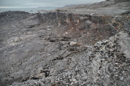
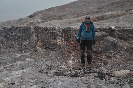
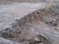
| The map shown above has several Q's numbered, but on the far left a little Q is without numbering, (see below left). Frigga is still doing research on details. Her thesis is expected May 2012 with many new details on Mansfield. The quarry must have been made between 1906 and 1919. There is no infrastructure like roads because the quarry is close to sea and the marble could easily be loaded on a boat at a steep cliff. The boats could be moored between two rocky outcrops. On the top of the cliff there are still two steel pins protruding from the marble as a kind of anchor for a crane or something like that. |
||||
 |
 |
|||
 |
 |
|||
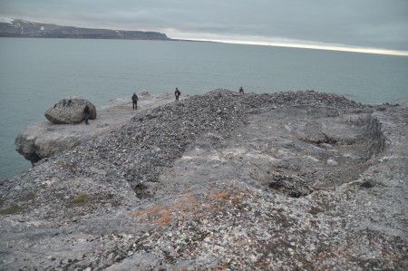
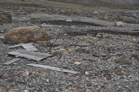
| Close to the quarry there are still traces of human activity. Some wood, parts of iron and in the back the remnants of a heap of coal, which must have been brought from Ny-Ålesund. | The coordinates of the quarry are 78.97356 N 11.98779 E. In the middle of the picture on the background you can see a small hut which is part of a communication infrastructure. | |||
 |
||||
|
||||
| For more information or reactions contact Frigga Kruse: f.kruse@rug.nl | ||||
[home] [weblog] [science] [people] [station] [ny-ålesund] [sightings] [sitemap] [nederlands]

|
|||||||
| [previous] | [present] | [next] | [overview] | ||||
 |
 |
 |
 |
||||
| 20110808, 15:00 | 20110724, 20:00 | 20110816, 1200 | all items shown with small pics | ||||
| girl power | marble quarry re-discovered | autumn |
This page has been given the following keywords: [history] [video] You can click on each keyword to get an overview about related pages. |